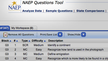
The National Association of Educational Progress is a government organization that tells us how our kids are doing in many subjects, including geography. But digging into the actual standardized test questions reveals some biased politics and bizarre geographic ideas. Let me give you one sample question that our American kids have to answer:
2010 ACTUAL QUESTION: Tropical forests are being destroyed at the rate of at least eleven million hectares each year, an area the size of Pennsylvania. About half of all tropical forests are already gone. Discuss two major reasons for this high rate of tropical deforestation.
OK, this is wrong on so many levels. Let's break it down:
"11 Million hectares destroyed"
No serious scientist today would validate this number. It dates back to a rough estimate made by a single Brazilian scientist looking at satellite photos of fires in the Amazon—in the 1980s! Yeah, it's a 30-year-old number based on sketchy information. Scientists today put the number at one-tenth that figure.
"...each year."
This implies there is a steady onslaught of rain forest destruction. Not so. There were some bad years in the 1980s, but things have changed radically since then. A report from last year showed a 90 percent drop in lost forest area.
"About half of all tropical forests are already gone"
Why is this sentence here? Seriously; it is absolutely unnecessary. The only reason to include this sentence is to make a political point.
"Tropical Forests"
This seems like an innocent phrase, but it's actually very tricky. Note how the test uses the term "tropical forest" not "tropical rain forest" That's because the test writers know full well that most deforestation in the Amazon is taking place in the chaco (dry forest) which is not an area of biodiversity. The wet tropical forests have a much slower rate of deforestation than chaco land.
"already gone"
Another subtle bias here: The word "already" is unnecessary, added to create a sense of urgency. In truth, deforestation has been going on in the Americas for hundreds of years.
Don't misunderstand—I'm not in favor of deforestation. But a standardized test isn't the place to push a point of view. And this wasn't the only question that had an obvious agenda. You can read through the questions on your own here.Tweet
Showing posts with label Map blunders. Show all posts
Worst geography blunder in a movie?
What movie has the worst geography error? Steven Seagal's Submerged is is classic—portraying Uruguay as mountainous (it's actually flatter than Kansas). Then there's the goof in Armageddon, where people all over the earth simultaneously celebrate the asteroid exploding—but it's not nighttime anywhere (That's a Michael Bay movie... he is notorious for this stuff). And there's Indiana Jones and the Kingdom of the Crystal Skull which consistently confuses Mexico and Peru. But my personal favorite is the 1969 disaster movie Krakatoa, East of Java that actually won an Academy Award. The problem: Krakatoa is west of Java. Ooops. (More movie geography errors here)
Labels:
Map blunders
Criminal Corner - Another spot for the perfect crime?
Yesterday we laid out the case made by legal scholar Brian Kalt that major crimes committed in the Idaho portion of Yellowstone National Park can not be prosecuted because of a legal loophole. Reader DanV wisely wondered why the same situation wouldn't also apply to the Montana portion of the park.
It does, sort of. Remember, the reason criminals would go free in Loophole Land is because a jury could not be formed from residents of the required location (the Idaho portion of the park) because no one lives there. But the Montana portion of the park does have residents... about 40 of them. That said, a sharp lawyer could argue that 40 people isn't enough of a pool from which to draw a jury, but a judge could reasonably disagree.
But if your heart is set on committing the perfect crime in Montana's "Criminal Corner" you do have one other option—get your buddies to do the same thing. While 40 residents might be enough for one jury, it wouldn't be enough for 3 or 4 simultaneous trials. So if you and your friends commit multiple crimes... and draw straws... only the loser would likely face a trial. That's because—by the time the 3rd or 4th trial could be scheduled—too much time would have passed for the "speedy" trial required by law.
But again, don't try this at home. Crime is bad. Prof. Kalt agrees... he just wants the loophole closed.
Labels:
Fun map stuff,
In the news,
Map blunders
Loophole land—where crimes can't be prosecuted. Really.
According to a law professor from Michigan, there is small section if Idaho where major crimes can not be prosecuted—thanks to a giant blunder by Congress.
The problem begins with the boundaries of Yellowstone National Park. Yellowstone is mostly in Wyoming, but a sliver of the park extends into Idaho and Montana. When Congress created the U.S. District Court of Wyoming it included all of Yellowstone National Park. Big mistake.
Stay with me here.... so let's say you commit a murder in the portion of Idaho that's in the park (The red "Loophole Land" on my map). You'd be arrested and bound over for trial in the US District court in Cheyenne, Wyoming. But Article III of the Constitution states that the trial must be held in the state where the crime was committed—in this case Idaho. So you are sent to Idaho for trial. No problem there. But the Sixth Amendment also says that the jury must be drawn from the state and District where the crime was committed. The state is Idaho... but the District is the Wyoming District (which includes the sliver of Idaho that's in the park). So the jury would have to be drawn from residents who live in the portion of Idaho that lies in the park.
And that's where it gets interesting: nobody lives in that patch of Idaho. Nobody. No jury pool means no trial, means you go free.
This curious loophole was discovered by Prof. Brian C. Kalt, a respected legal scholar from Michigan State University. Georgetown Law Journal is reporting on the matter in an upcoming issue. (You can read Kalt's full article here)
Of course, committing crimes is bad. Don't do it. But if you're a screenwriter, this is great stuff! Maybe Dick Wolf will start a new series Law and Order: Idaho just to take advantage of this legal anomaly.
And if all this wasn't bizarre enough, Idaho's "Loophole Land" is just a few steps from another patch of American soil that also fell outside the law. Dubbed "Lost Dakota" it was a few acres of land that—erroneously—were not part of any state and thus, theoretically, outside the reach of law enforcement. (Much more on this in my book Lost States) Eventually that situation was fixed when Lost Dakota became a part of Montana. But Loophole Land remains an unsettling, well, loophole. If your nemesis suggests a camping trip near the Idaho/Wyoming border.... don't go!!!
Labels:
Fun map stuff,
In the news,
Lost States,
Map blunders
Snooki vs Montana
No one is likely to be surprised that Snooki from Jersey Shore is a bit of a dim bulb. But her geographic illiteracy was on full display last week when she was interviewed by a Montana radio station. Snooki asked, "Where is Montana? Is that a state?"
That gives me an idea for next season... send Snooki and company to Montana... let 'em work on a ranch... get bucked off a bronco... step in buffalo dung. Now that would be entertaining.
Labels:
Map blunders
National Geographic's map fail
The National Geographic Society should know better. I've always been a little frustrated that their yellow-bordered National Geographic magazine seems to focus more on sharks and bears—and less on actual geography. Today, for example, their home page features robots playing soccer. How is that geography, exactly? I mean, if they had a real focus on maps and geography, they never would have used the photo above to promote their "National Geographic World Championship."(It's kind of like a geography bee). Of course, no disrespect to Pranav Bhandarkar, Stefan Petrovic´, or Anthony Cheng who are all admirable young participants. The issue is the map. Regular readers will see the blunder right away. Here's a hint: the World Championship took place just a few days ago... in late July.
Labels:
Map blunders
Tennis pro fails geography
When tennis pro Bojana Jovanovski landed in Carlsbad, New Mexico for the Mercury Insurance Open last week, everything seemed fine—until she realized she was in the wrong Carlsbad. The tournament was in Carlsbad, California. Oops. If only her travel planner had a paid a bit more attention in geography class, she wouldn't have made the 1,000 mile blunder. Jovanovski did eventually get to her match in California... with just minutes to spare. She lost. Hopefully, her next stop won't be Wimbledon Boulevard in Columbus, Ohio. (You can read more about Jovanovski's Carlsbad experience here.)
Labels:
Map blunders
Columbus stamp goof - revealed
Yesterday we posed the question: What's the geography goof on the 1993 Columbus stamp? I must say I had the same question as reader Phil, who wondered about possible lines of latitude and longitude on the map that's laying in front of Isabella. So I blew up the image (upper left), revealing that the lines are not parallel, so that's not really a mistake. At least I don't think so. And, like reader Enigma149, I did see Florida on the map—which Columbus would not have known. But, in fairness, that's probably more of Rorschach blot.
The big error, (as readers Ken, tkrausse, and kzimman noted) was the globe. Yes, most smart people in 1492 knew the world was round, but there was just one globe in existence (as far as historians can tell), and it never left Germany. And that globe wasn't a tabletop model—it was a much bigger, floor-standing unit. So that's the most serious error in the stamp above. But there is one more thing... as best we know, Columbus was 41 when he made the pitch to Isabella. Does the guy in the stamp look 41 to you? That's the same age Vince Vaughn is now... and Jack Black. Ah, there's a high-concept movie idea: Jack Black as Christopher Columbus.
Labels:
Map blunders
US stamp's Columbus error
This 1992 US stamp has a significant geography goof. It's supposed to show Columbus pitching Isabella on the idea of a westward journey across the Atlantic. But one thing in this scene is all wrong. By the time historians caught it, the stamp was already in circulation—and it was never changed. To view it more closely, I've posted a much bigger version here. Take your guesses... the answer tomorrow!
Labels:
Map blunders
Map errors on postage stamps? Yep!
You'd be surprised how many stamps have major map errors. One classic goof is the above US stamp commemorating the 1803 Louisiana Purchase. Unfortunately, the map does not show 1803 Louisiana accurately. Back then, the territory went above the 49th parallel-- meaning the familiar straight-line border at the top of the USA is wrong. Plus, this map includes the bottom of Alabama and Mississippi, (known then as West Florida) as a part of Louisiana. The US didn't acquire that land until 1819. Oops! For a big list of other map mistakes on stamps, visit this site.
Labels:
Map blunders
The Alaska puzzle puzzle
You know those wood map puzzles we all had as kids (well, mine was cardboard because we were poor)... anyway, they're a nightmare to manufacture; Rhode Island is too small, the panhandles of Idaho and Oklahoma break easily etc.. So I understand if the puzzle companies have to simplify the borders a bit. A bit. But sometimes they go too far. Check out this Alaska puzzle piece I saw at Target yesterday. That's the worst map of Alaska I've ever seen. And New Mexico's not much better—apparently the map designer never heard of the Gadsden Purchase.
Labels:
Map blunders
Biggest map goof ever?
Maps have errors all the time, but usually those errors aren't cast in stone (or a copper-zinc-nickel alloy). But that's exactly what happened with the map on the Georgia commemorative quarter.... they got the map wrong. No kidding. If you have one of these you can look for yourself. The coin doesn't have Dade County, which is the upper left corner of the state. The error is especially weird, because Dade County tried to secede from Georgia in the Civil War era (more on this in Lost States). Yesterday, the Atlanta paper revisited his oddity (their link down, here is another). We're shocked the error was never fixed. (What if it had been a US map... and they had left off Washington DC? Well... that might be an improvement.) Anyway, we were so upset that they never corrected this map goof, that, darn it, we made the fix ourselves. Now, for the first time, you can see what this coin was supposed to look like.
Labels:
Map blunders
Impossible to get an accurate world map?
Today is the first business day of a world with 196 nations (South Sudan was added on Saturday). So where can you get an updated world map? It's harder than you might think. National Geographic isn't selling one. One of the best sources of free maps is the CIA, but their Africa map has not been updated either. Maps.com isn't selling an updated map. Even Google and Bing are not showing the new nation (although I expect them to soon. Let me know when you see it). The British Guardian put out an updated map, but I must say that the coloring is annoying, and it's not easily downloaded. One might expect this lack of maps if South Sudan had been created by some overnight coup. But that's not the case, this country was the result of a treaty signed 6 years ago.... plenty of time to get up to speed. The oddest example is the CIA... the guys who are supposed to be ahead of the curve in world affairs. I'm sure they're not stumbling around today, "What, a new nation?! We better get on this!" So, to reassure the American public that they are on top of things... please, update your maps, CIA.
[My map is only regional, but you can see it here.]
[My map is only regional, but you can see it here.]
Labels:
In the news,
Map blunders,
New Nations
Geographic illiteracy (& Transformers) explained
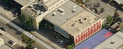
Why don't Americans know their geography or history? A big part of the problem is institutions like Crossroads School, the super-exclusive K-12 in Santa Monica where Hollywood stars send their kids. Transformers director Michael Bay is a Crossroads alum, which may help to explain the geographic illiteracy endemic in his films.
Steeped in the religion of post-modernism, Crossroads teaches that right answers aren't really important. Here are actual quotes straight from their web site. You won't believe this:
CROSSROADS
--We believe that students learn from one another and from the world around them rather than solely from the teacher.
This explains why Crossroads graduate Michael Bay dropped Israel from the map in Transformers 2... he wasn't pressured to worry about all those silly facts in school. I can almost hear the teacher telling little Michael, "If you don't think Israel is a country, that's fine. And if you think 2+2=5.... that's your right as an empowered person." So we can't really blame Michael Bay for errors like putting Washington DC in Illinois. The blame begins at places like Crossroads—the school that is prepping the famous of tomorrow (like alum Spencer Pratt).
If you don't see the shortcomings of the Crossroads approach to education, imagine this... let's say you are looking for a doctor to do your heart surgery. Would you want a surgeon trained at a medical school that espouses the Crossroads philosophy? Imagine Crossroads Medical School... "where we believe that students learn from one another and from the world around them --not from an experienced surgeon. We encourage surgical students to cut where it feels right... and develop their own modes of surgical expression unhindered by traditional knowledge."
In fairness, the teachers at Crossroads are all probably nice people who think they are doing the right thing. They actually believe that indoctrinating kids in the "there-is-no-truth" philosophy of post-modernism is a good thing. I would argue that there are facts. And there is an objective right and wrong. History matters. Autobots are good and Decepticons are bad (At least Michael Bay got that one right!)
Steeped in the religion of post-modernism, Crossroads teaches that right answers aren't really important. Here are actual quotes straight from their web site. You won't believe this:
CROSSROADS
--We believe that the process of learning is more important than the product or “right answer”
--We view students as thinkers with emerging theories about the world rather than as recipients of knowledge from the teacher.--We believe that students learn from one another and from the world around them rather than solely from the teacher.
This explains why Crossroads graduate Michael Bay dropped Israel from the map in Transformers 2... he wasn't pressured to worry about all those silly facts in school. I can almost hear the teacher telling little Michael, "If you don't think Israel is a country, that's fine. And if you think 2+2=5.... that's your right as an empowered person." So we can't really blame Michael Bay for errors like putting Washington DC in Illinois. The blame begins at places like Crossroads—the school that is prepping the famous of tomorrow (like alum Spencer Pratt).
If you don't see the shortcomings of the Crossroads approach to education, imagine this... let's say you are looking for a doctor to do your heart surgery. Would you want a surgeon trained at a medical school that espouses the Crossroads philosophy? Imagine Crossroads Medical School... "where we believe that students learn from one another and from the world around them --not from an experienced surgeon. We encourage surgical students to cut where it feels right... and develop their own modes of surgical expression unhindered by traditional knowledge."
In fairness, the teachers at Crossroads are all probably nice people who think they are doing the right thing. They actually believe that indoctrinating kids in the "there-is-no-truth" philosophy of post-modernism is a good thing. I would argue that there are facts. And there is an objective right and wrong. History matters. Autobots are good and Decepticons are bad (At least Michael Bay got that one right!)
Labels:
In the news,
Map blunders
Michael Bay drops Israel from the map
The second Transformers movie concludes with a big battle near the border between Egypt and Jordan. The problem: there is no such border. The two nations don't meet. Israel is in-between. In fact, Israel was totally eliminated from the movie... even though the Israeli air force would have been handy in fighting the Decepticons. This isn't Michael Bay's only head-scratching geography error. In the current Transformers movie, he puts Washington DC in Illinois. Hey, I realize the Transformers movies are not meant to be educational films, but these errors (and lots of others) show the contempt Michael Bay has for his audience. He has to assume that viewers are so stupid, they won't notice this stuff. Maybe he's right. If so, we're all in deep trouble. (That reminds me, I should probably check the DVD of Bay's Pearl Harbor. It wouldn't surprise me if—in Bay's version—the U.S. was attacked by China.)
Labels:
Map blunders
Michael Bay's map fail
In the new Transformers movie, one of the endless impossible-to-follow chase scenes takes place in Washington DC. However, Illinois highway signs are clearly visible in the scene. You'd think with all the money spent on special effects, the filmmakers could show enough respect for the audience to at least digitally replace the signs. Does director Michael Bay assume we are so geographically illiterate that no one will really notice? What next, a Los Angeles chase scene with the Statue of Liberty in the background? Actually, we shouldn't be surprised. In the last Transformers movie, Michael Bay completely removed Israel from the map. (More on that tomorrow.) Much thanks to Duane Dudek, who pointed out Bay's geographic disrespect.
Labels:
Map blunders
There's no state named "Rhode Island"
It's true. There is no state named "Rhode Island." The actual name of the smallest state is "State of Rhode Island and Providence Plantations." "Rhode Island" is just a nickname. The state's official name is so long, it won't fit on any map... no even a map that's actual size. So the state usually goes by its nickname. Last year, voters cast ballots on whether to make the shorter name official. Some thought the word "plantations" had ugly connotations of slavery, others defended the state's history on this issue. The measure lost, and so the long name remains official So, please refer to the state by its official name. I mean, if we start shortening state names for convenience, think of the result. We'd have states named "Al" and "Ken" and "Ida" and "Minni" and "Cal" and "Tex."
Labels:
Map blunders
NFL creates dumbest maps ever
Please help me understand the point of a series of bizarre maps on the NFL web site. Hey, I'll find any excuse to like a map, but does anyone really need to see the weekly travel of each team? Look at the example above. Does that tell you anything useful? OK, I guess the map shows that, say, the Green Bay Packers are traveling to Kansas City... or is it Denver? I'm a map geek and I can't tell! Besides, wouldn't it be more useful to just type up, "Green Bay at Denver"? (Or is it Denver at Green Bay? I can't tell from this stupid map.) Wait, wait, I think I figured it out! If you squint just right at all the crosshatchy red lines, you will see the Chinese symbol that translates roughly, "season cancelled suckers." Feel free to investigate this series of pointless maps here.
Labels:
Map blunders
Fond du Lac, Rachel Maddow, and Appleton
I spent yesterday giving a talk at the fun Fox Cities Book Festival. One of the cities of Wisconsin's Fox Valley is Fond du Lac... recently in the national spotlight because MSNBC host Rachel Maddow just cannot figure out how to pronounce this city. The MSNBC personality messed up "Fond du Lac" recently, and went on the air to correct it. Alas, her correction needs correcting--because she mis-pronounced it again! In her correction she's calls it "fohn-du-LACK" emphasizing the last syllable. I had the fine locals of nearby Appleton say it in unison yesterday, and I can tell you they did not say fohn-du-LACK. They said FOHN-du-lack with the first syllable getting the slightest preference. And if you want to get all the vowel sounds right, say "John do crack" and you pretty much have it. Even though I'm no fan of Ms. Maddow, I'll link to her whole mea culpa here. (Oh, and in case you are wondering, "Appleton" is pronounced just the way you'd expect.)
Labels:
Map blunders
This is why we need more geography teachers...
I don't know were to begin with this stupefying exchange from Yahoo Answers. I didn't make this up. This is real. "Nick" asked: Why isn't Alaska count(ed) as the 51st state? Let me stop right here. A lot of teachers will say "There really are no stupid questions." But I'm here to tell you: THAT is a stupid question! If Nick is old enough to spell "Alaska," he should know it's a state... and that the US has 50 of 'em. And if somehow he slept through social studies class every day of elementary school, then he should at least have the self-respect to look this up himself. Does Nick really have to involve other people in his quest for getting an answer to this question? What next from Nick? How come there has never been an African-American president? How many wheels does a bicycle have? or How do you spell "Nick"? Sigh. At least Nick is polite; I guess that counts for something. But he demonstrates the need for more geography in our schools.
Labels:
Map blunders
Subscribe to:
Posts (Atom)